Freeway Free Chicago
What would the Windy City look like without its freeways?
The University of Notre Dame architecture faculty, alumni, and graduate students created a , looking toward the bicentennial of Daniel Burnham's famous 1909 Chicago plan. In the Notre Dame view, the Interstates that currently plow through The Windy City neighborhoods are enormous opportunities to turn into new parkways, streets, and public spaces in the 21st Century.
I present that plan, completed from 2011 to 2014, because CNU just published A Freeway Free San Francisco, outlining a vision to remove limited-access highways within San Francisco. The benefits to transportation and livability are proven by the city's own experience with freeway teardown following the Loma Prieta earthquake.
Other cities could also gain from following this strategy. It starts with a bold vision.
Many of the ideas and images are stunning from Notre Dame's "After Burnham" are magnificent. The following are just a sampling, courtesy of Professor Philip Bess. Right click on the images to open them in a new tab and make them larger.
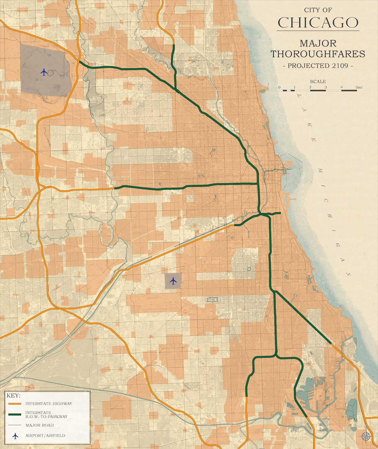
Green indicates existing Interstate right-of-ways converted to parkways in the plan.
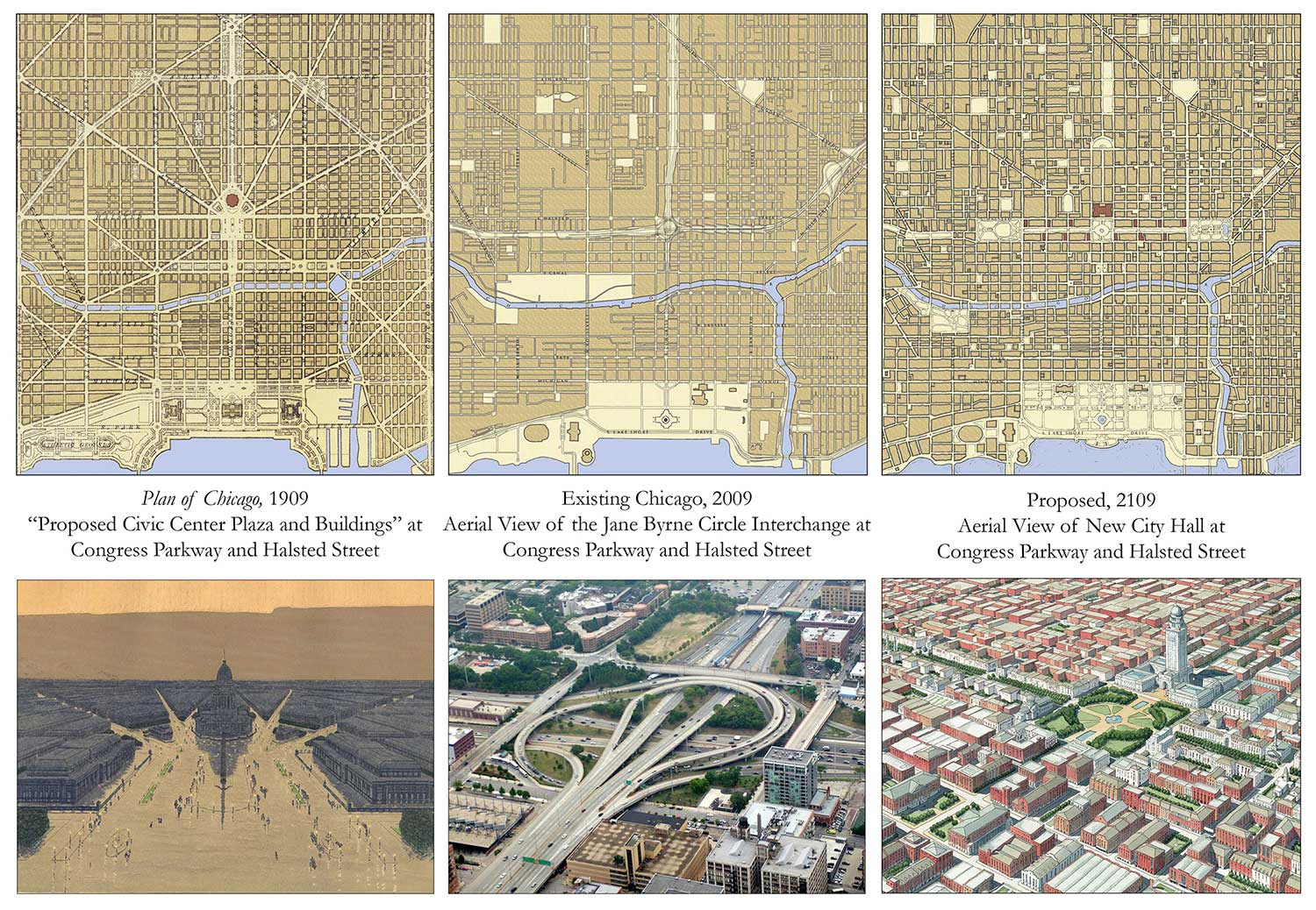
Burnham's proposed civic center, the existing Jane Byrne Circle interchange, and a restored public space with a city hall in 2109.
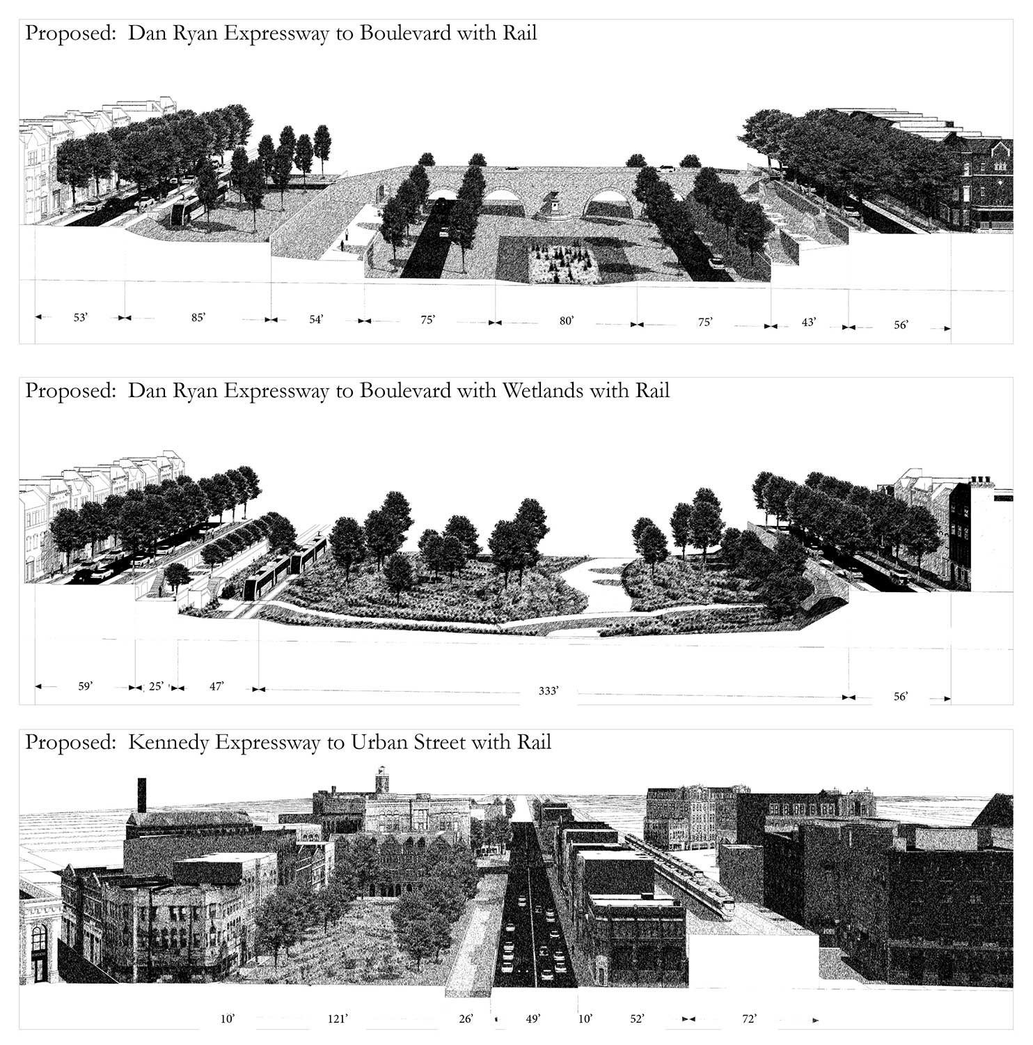
Sections of Interstate right-of-way following conversion.
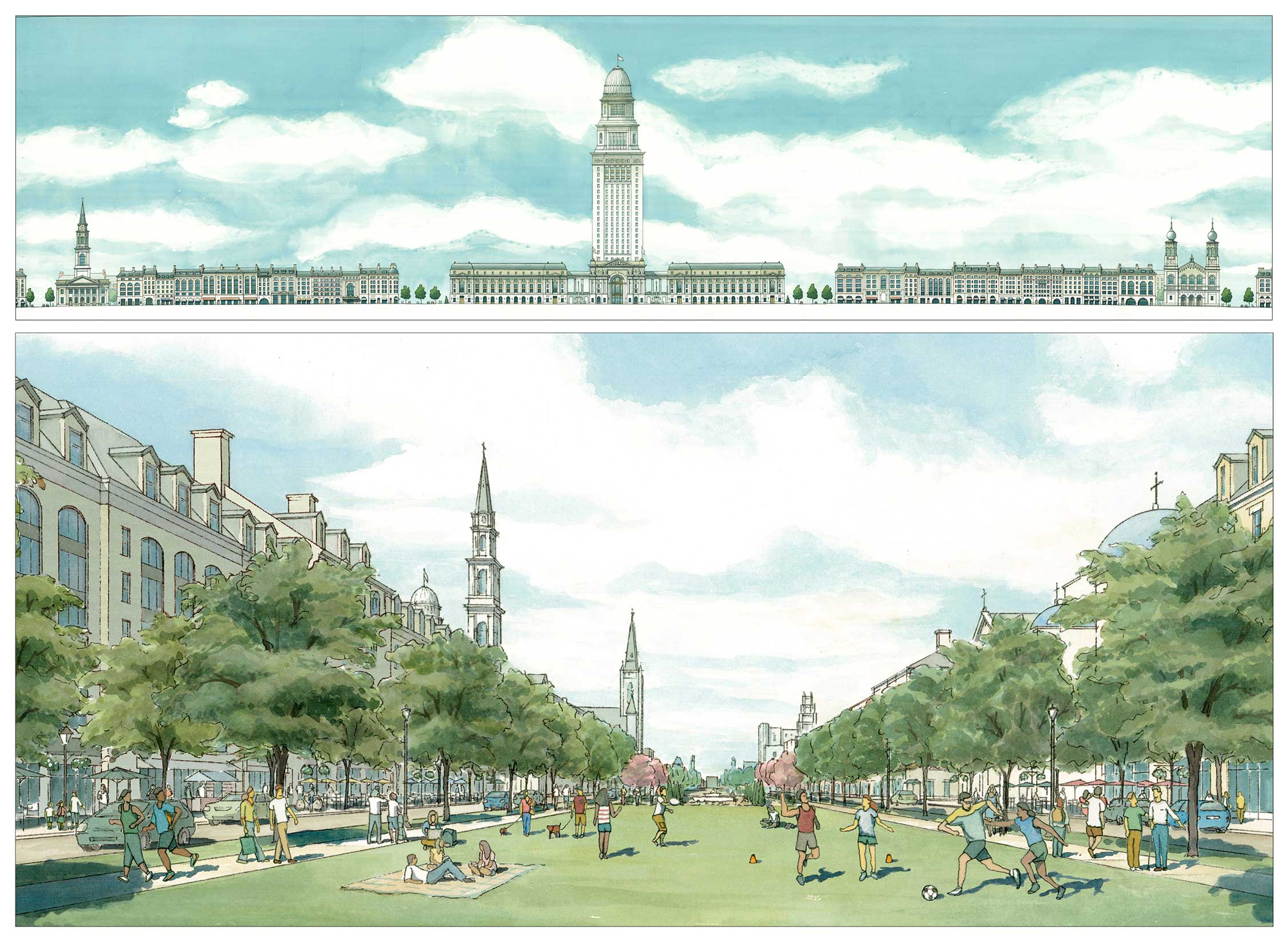
A parkway created from one of the Loop highways.
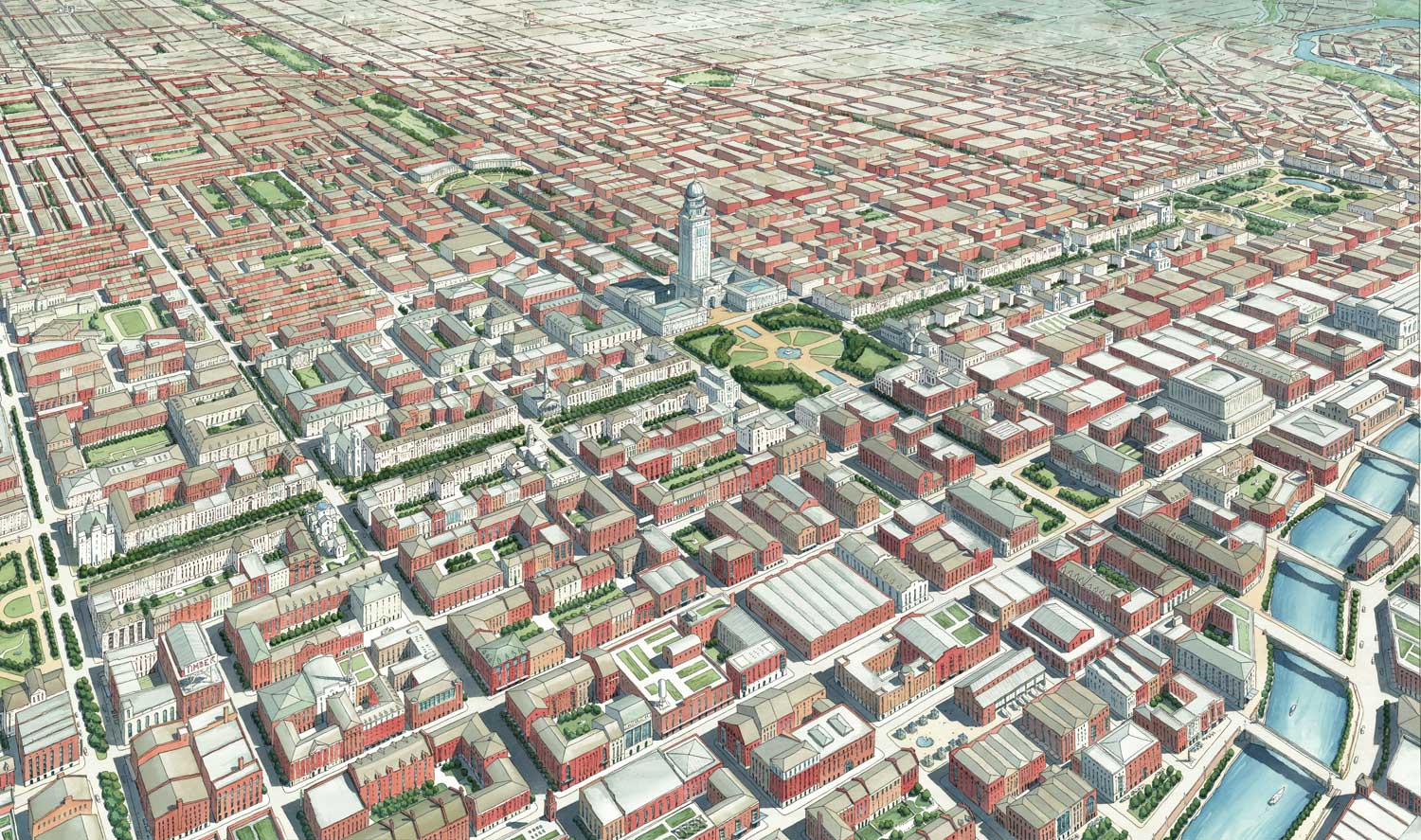
An aerial looking Northwest over one of the converted Chicago Interstates.
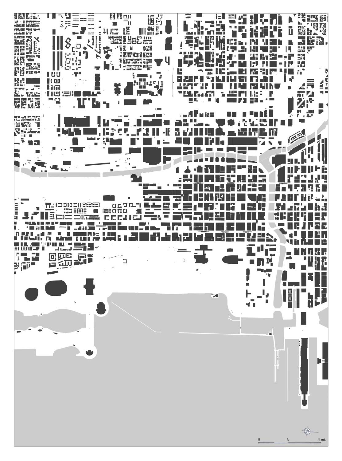
Figure ground drawing of existing conditions.
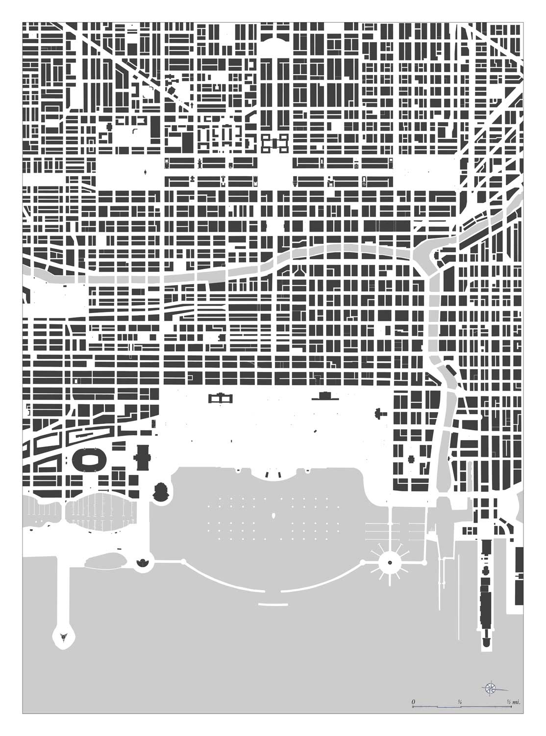
Figure ground for 2109
Robert Steuteville is executive director of Better Cities & Towns.
Comments