- 1. Content
- 2. Quarry Path - 3.5 Kilometers
- 3. Alexander von Humboldt Trail - 5.3 Kilometers
- 4. Goethe Trail to Ochsenkopf - 5 Kilometers
- 5. Bischofsgrün Panorama Trail - 10.2 Kilometers
- 6. Thiesenring - 11.5 Kilometers
- 7. Kaiser Trail - 14.9 Kilometers
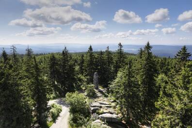
- 8. Schneeberg - 16.2 Kilometers
- 9. High Trail - 45.9 Kilometers
- 10. East Route - 59.1 Kilometers
- 11. Franconian Mountain Trail - 425 Kilometers
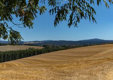
As a lushly forested and verdantly green low mountain range, the Fichtelgebirge in Bavaria is a paradise for hikers. Several long-distance hiking trails open up the hills and valleys of the region, and two European long-distance hiking trails also cross the low mountain range.
We reveal which of the total 3600 kilometers of marked hiking trails you should tackle. Here are the ten most beautiful hikes in the Fichtelgebirge, from short routes to multi-day tours.
Content
- Quarry Path - 3.5 Kilometers
- Alexander von Humboldt Trail - 5.3 Kilometers
- Goethe Trail to Ochsenkopf - 5 Kilometers
- Bischofsgrün Panorama Trail - 10.2 Kilometers
- Thiesenring - 11.5 Kilometers
- Kaiser Trail - 14.9 Kilometers
- Schneeberg - 16.2 Kilometers
- High Trail - 45.9 Kilometers
- East Route - 59.1 Kilometers
- Franconian Mountain Trail - 425 Kilometers
Quarry Path - 3.5 Kilometers
The name says it all: the Quarry Trail leads to six different quarries, combining a simple hike with exciting sightseeing. The path alternates between ascending and descending and overcomes an elevation difference of 120 meters.
The actual walking time is 1.5 hours; however, if you plan to stop along the way and admire the quarries, you should allocate double the time. At the end, a detour to Epprechtstein Castle Ruin is well worth it, offering a magnificent panoramic view of Kirchenlamitz and the inner Fichtelgebirge.
Tour: 3.5 Kilometers, 117 Meters Elevation, 1.5 Hours (with sightseeing about 3 hours)
Alexander von Humboldt Trail - 5.3 Kilometers
The scholar Alexander von Humboldt is inseparably linked with the Fichtelgebirge. It's hardly surprising that the region named a hiking trail after him. The route leads through and around Arzberg, where Humboldt worked for five years as Chief Mining Officer and even founded a mining school. Along the way, you pass various stations he influenced, such as the 'Kleiner Johannes' mine, the brewery, his residence, or the last remaining mining building in Arzberg.
Tour: 5.3 Kilometers, 82 Meters Elevation, 1.5 Hours
Goethe Trail to Ochsenkopf - 5 Kilometers
The most famous poet who lost his heart to the Fichtelgebirge was Johann Wolfgang von Goethe. He visited the Ochsenkopf in 1785, which is why there's now the Goethe Trail up to the Ochsenkopf summit. The hiking trail leads over the Weißmain rocks at the Weißmain spring to the second highest mountain in the Fichtelgebirge. Appropriately, the path is marked with the symbol of an orange book.
Tour: 5 Kilometers, 300 Meters Elevation, 1.5 Hours
Bischofsgrün Panorama Trail - 10.2 Kilometers
Bischofsgrün is the only climatic health resort in Northern Bavaria. Around the town, there are about 300 kilometers of trails, with the most beautiful tour leading along the Bischofsgrün Panorama Trail. From the base station Nord Ochsenkopf, it goes past the ski jump, along a forest path towards the Hügelfelsen, further via the Ochsenkopf road to Göhren and the Glasermühle. You then hike through the Bischofsgrün hamlets Rangen and Hohehaid to the height clinic and from there back to the starting point at the base station North.
Tour: 10.2 Kilometers, 362 Meters Elevation, 3.5 Hours
Thiesenring - 11.5 Kilometers
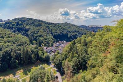
Around Bad Berneck, one of the most beautiful trails in northern Bavaria leads through impressive viewpoints and historical sites such as castles and mines. The trail is named after Carl Thiesen, a benefactor and honorary citizen of Bad Berneck. Along the way, 23 themed panels provide information about landscape, nature, and history. Additional information is available via QR codes.
Tour: 11.5 Kilometers, 516 Meters Elevation, 4 Hours
Kaiser Trail - 14.9 Kilometers
The Kaiser Trail connects the town of Kaiserhammer in the Fichtelgebirge with the city of Eger (Cheb) in the Czech Republic. Much of the trail follows the Eger Hiking Trail and passes through the Eger Valley. Information panels along the way explain the many preserved cultural landscape elements, historical uses, geological features, water management topics, and the unique nature.
Tour: 14.9 Kilometers, 212 Meters Elevation, 4.5 Hours
Schneeberg - 16.2 Kilometers
Many trails lead to the highest peak in the Fichtelgebirge, but one of the most beautiful routes starts from the shores of Weißenstädter Lake, ascending to the summit. The trail passes rocky cellars, through meadows and forests; only the last stretch follows a road closed to public traffic.
Tour: 16.2 Kilometers, 500 Meters Elevation, 3 3/4 Hours
High Trail - 45.9 Kilometers
One of the most beautiful and oldest trails in the Fichtelgebirge leads from Schwarzenbach to Wunsiedel. The High Trail spans a total of 47.5 kilometers and should be divided over two or three days. Along the way, you will pass many of the region's highlights: rock towers and seas of granite blocks, but also the peaks of Waldstein, Schneeberg, Hoher Matze, and Kösseine. For those who want to do it all in one go, overnight stays are available in huts like the Waldsteinhaus and Seehaus.
Tour: 45.9 Kilometers, 1255 Meters Elevation, 14 Hours
East Route - 59.1 Kilometers
At the tri-border area, the East Route begins, leading over 56 kilometers into the monastery town of Waldsassen. The trail runs right along the Czech border and goes through the Rehau Forest, across the ridgeline of the Wartberg near Selb, and the natural forest reserve around Hengstberg, the largest contiguous deciduous forest area in the Fichtelgebirge.
The route descends into the Eger Valley, through the border town of Hohenberg an der Eger and the Arzberg Forest to Waldsassen. Along the way, there are wide views into Saxony and the Czech Republic.
Tour: 59.1 Kilometers, 215 Meters Elevation, 18 Hours
Franconian Mountain Trail - 425 Kilometers
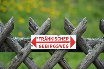
The Franconian Mountain Trail covers a total of 425 kilometers, traversing Frankenwald, the Fichtelgebirge, the Steinwald, Franconian Switzerland, and Hersbrucker Switzerland. Since 2007, hikers can walk the long-distance trail in individual stages or take longer tours. After each stage, you can stay overnight in a hiking hotel. For long-distance hikers, there's an excellent infrastructure along the way.
The trail features impressive peaks and notable towns, especially Bayreuth, Waldsassen, Pegnitz, and Zell in the Fichtelgebirge.
A beautiful section is the 13th stage, which runs nearly 13 kilometers from Goldkronach to Bayreuth. Along the way, you pass opulent buildings like Leisau Castle as well as the three streams Kornbach, Seelohbach, and Saulochbach. In Unterstainach, it's worth taking a break at one of the inns before continuing along the nature reserve 'Steinachtal mit Deichselhölzchen' to Bayreuth.
Tour: 425 Kilometers, 7086 Meters Elevation, 120 Hours; Part-Stage Goldkronach - Bayreuth: 12.8 Kilometers, 240 Meters Elevation, 3 3/4 Hours
bettercities.net